We all get the post turkey slump after seven rounds of Grandma’s Christmas dinner followed by a large helping of chocolate Yule log.
To help combat this, why not go for a long walk or bike ride and see what the borough has to offer. Whether you’re in Immingham, Grimsby or Cleethorpes, there are plenty of options out there.
Fishermen and Ships – Cycling, Grimsby
Suitability – Adults and older children
Distance – 12 miles (19km)
Ride time – 1hrs 30mins
Terrain – Mostly flat
This ride takes in views across the Humber and the picturesque local villages of Great Coates, Stallingborough and Healing. The start of the ride is at Grimsby Leisure Centre on Cromwell Road. There is free car parking available at the Leisure Centre.
When you join the seawall, do stop for a moment and take in the view. The Humber Estuary in front of you is one of the busiest areas of water in the country with ships from all over Europe and beyond visiting the nearby ports of Grimsby and Immingham.
The river itself drains around 20% of the total land surface of England. The estuary is around 100,000 years old and was formed during the last Ice Age, when it is believed that an ice sheet plugged the mouth of the river causing the build-up of silt and debris behind it. When the ice melted the sea flooded in covering much of the lowlying land creating the estuary as we see it today.
As well as being busy with industry, the river is also home to a host of wildlife. As you ride along you may be lucky enough to see flocks of wading birds feeding on the tiny invertebrates that inhabit the estuary’s mudflats. At high tide, when the area is covered in water, you are likely to see local fishermen looking for a catch.
As the route turns away from the water it passes through the historic village of Stallingborough. Dating back to before the Doomsday Book the ancient village site is still visible in a series of earthworks to the west of the village church. You may wish to stop off at the village shop or nearby pub for some refreshments before heading back to the start of the ride via Healing.
The route:
- Leave the Leisure centre grounds and turn left onto Cromwell Road
- To your left is a small cutting through to Great Coates. Please dismount and walk your bike through the cutting, at the end turn right and re-join the road along Station Road
- At the junction of Woad Lane and Moody Lane go straight ahead along the Public Bridleway towards the sea
- At the end of this path turn left and cycle along the seawall
- After approximately 1 ¼ miles turn left off the seawall. At this point you may need to dismount to pass around a barrier
- Follow the track to the junction of South Marsh Road and Hobson Way, turn right then immediately turn left towards Stallingborough. Head straight along South Marsh Road and Station Road through the village for approximately 2½ miles
- At the roundabout turn left onto the B1210 towards Healing
- As you enter Healing you may wish to join the off road cycle path on the lefthand side of the road. You can follow this path all the way to Grimsby
- At St Michael’s Church turn left onto the path alongside the Freshney passing through a small wooded area
- Follow the path until you reach a T-junction, turn right here and keep the fence to your left-hand side, at the end of the path turn left onto Yarrow Road
- At the junction with Yarborough Road turn left and join the off road path, at the next junction turn left onto Sorrell Road
- Follow this road to the junction with Spark Street where you should turn left.
- At the junction with Cromwell Road turn left and head back towards the start point at the Leisure Centre
Mayflower Woods – Walking, Immingham
Notes – Accessible by public transport. Suitable for walkers with dogs
Distance – 2.25 miles (3.5 km)
Difficulty – Steady
Discover the countryside in this 2¼-mile wander to the north of Immingham taking in the privately owned Mayflower Woods. The 120 acres of planted woodland is owned by the Humber Refinery of Phillips 66. Humber Refinery of Phillips 66 open via Permissive rights of way.
Immingham has existed as small settlement since the early medieval period. The town was mentioned in the Doomsday Book, recorded as Imungeham. Its Anglo-Saxon name is thought to mean the ‘homestead of the people of Imma’. Up until the 1900s it was a rural hamlet, made up of farms and cottages and was surrounded by marshland. Today, Immingham is the largest port by tonnage the UK.
This walk starts at St Andrew’s church which dates back to the early medieval period with much of the structure dating to the 13th century. Sited on some of the highest ground of the port and town, the 500-year-old tower commands a good view of the town and countryside. See if you can spot the gargoyle on the bell tower who points its naked backside towards Killingholme!
Immingham was the last departure point for the Pilgrim Separatists who fled England in 1608 for Holland. These individuals later boarded the Mayflower ship for the new world and founded one of the first English colonies in America. It was on the shores of Immingham that a group of people gathered to travel to Holland. Across from St Andrew’s church you can also visit the Pilgrim’s Monument.
Once you have walked the length of Mill Lane, the route follows well established local footpaths and goes through Mayflower Woods emerging onto the old golf course and back to the church.
After your walk you can enjoy some refreshments in the town centre and perhaps pop into the museum to learn more about the town’s heritage.
The route:
- Leave the Church following Church Lane for a short distance then turn down Mill Lane continue along the lane walking past Immingham Parish Cemetery on the right
- At the sharp bend turn right following the direction of the footpath sign along a stony track which eventually changes
to a grassy field edge path - Cross the bridge and continue straight ahead along the well trodden path
- At the big drain turn right following the direction of the way markers along the path with the drain on your left side
- Pass through a kissing gate and continue along the path along the drain side
- Pass through two more kissing gates close together and continue along the well trodden route through the woodland
- Cross the bridge and immediately turn left along the drain side
- Turn right along the edge of the trees across the golf course back to the car park
- Cross the car park and follow the path around the church back to the start
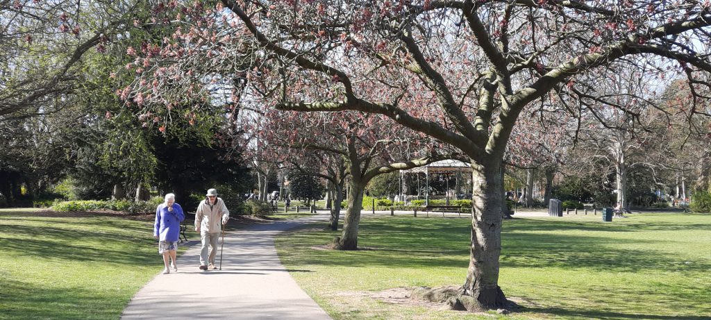
Country park – Walking, Cleethorpes
Suitability – Accessible by public transport. Suitable for wheelchair users. Suitable for walkers with dogs
Distance – 2.25 miles (3.5 km)
Difficulty – Easy
An oasis in the middle of town, Cleethorpes Country Park was established in 1988 and covers an area of over 64 hectares of open grazing pasture, woodlands and a large lake with abundant wildlife and waterfowl.
Within the Country Park there are a variety of walks to choose from, the easiest and most accessible is a stroll around the lake on the tarmac path. This route is idea for anyone looking to get a bit of light exercise or anyone with mobility impairments. Look out for the displays around the lake for more information about these walks.
There are several accesses into the park for pedestrians, motorists can access the area via Park Lane (just off Humberston Road and North Sea Lane), there is a large car park with a picnic area and toilet facilities. Bus services, No 7,8,9 or 10 all stop close to the park making the walk easy to get to from all over Grimsby and Cleethorpes.
As well as being a great place for a walk the park also has areas dedicated to fishing, pond dipping, boating and there’s even a dedicated area for dogs to swim in. After your walk why not pop along to Cleethorpes Seafront where you’ll find a host of places to eat, drink and relax.
The route:
- Leave the car park by the southeast exit and head up the path towards the lake
- At the first junction take the path to your right
- Follow the path straight ahead towards the bridge
- Before crossing the narrow footbridge turn left and follow the track keeping the beck to your right hand side
- Turn left onto Grimsby Road
- At Martin Wragg Way turn left and re-enter the parkland, follow the path heading towards the lake
- In the small wooded area follow the path straight ahead
- At the circular blocked paved area turn right and head back towards the car park
This is just one of the walks around the Country Park, look out for more walks on the display board by the car park
To download these guides and others across the borough, visit Discover North East Lincolnshire | Walking trails – Discover North East Lincolnshire.
However, if you fancy getting in the Christmas spirit sooner, take a look at our Festive Walks page and discover Winter Walks, ideas and some top tips for a great festive walk around the borough. To get involved in our other Christmas activities, including the New Year’s 10k run and sea swims, visit the Active Xmas page on Discover North East Lincolnshire.
For more great ideas for things to do in our area follow Discover North East Lincolnshire on social media especially their weekly what’s on posts, key an eye on their events listings on their website and sign up to their monthly newsletter here.
Share this article